DGPS & GIS Survey
We are leading service provider of DGPS Survey and GIS Survey for all Sectors. Differential Global Positioning System (DGPS) is an enhancement to Global Positioning System that provides accurate location within 5 mm accuracy in case of the best implementations. Our high experience Engineers uses high Precision Dual Frequency GPS equipment like Topcon Dual Frequency Hyper II for best result. Our Organization is a prominent organization engaged in providing highly efficient services in the field of DGPS & GIS Survey.
Contact Us

Topographical And Levelling Survey
We provide Topographical/Levelling Survey Services that help in developing works of all civil sectors. We provide these services at most competitive prices. Our professionals are very experienced and provide accurate data using latest, modern and scientific survey equipments and enable us in providing quality services. Moreover, we use various topographical maps to offer reliable and industry standard services.
Contact Us
Contour Survey
We have been widely appreciated for offering excellent solution in form of Contour Survey. The survey is carried out as per the international quality standards and is offered to civil engineering firms. We are able to smoothly execute the service with the aid of our CAD designs and conventional drawings.
Contact Us
Transmission Line and Route Alignment Survey
We are engaged in offering Transmission Lines Survey Services to the clients. Our engineers provide optimum solutions to the clients by using modern survey instruments i.e. GPS, Total Station and latest software's for Transmission line survey and profiling.We use PLS CAD for digital tower sporting profiling.
Contact Us
Bathymetry & Hydrographic Survey
We provide superior quality services in Bathymetry and Hydrographic Survey using latest, modern and scientific instrument i.e. total station, Echo Sounder, DGPS, and latest software. Our team is well qualified and experienced.
Contact Us
Traffic Survey
Our experienced and professional team provides the accurate census data of traffic survey for the best planning and designing of civil work project. Traffic Survey is playing the most important role in the planning of any civil project. We use the latest equipment for traffic census.
Contact Us
Geotechnical Survey
Geotechnical investigations are executed by our expert geotechnical engineers. All civil works are design based on Geotechnical Survey results. Accurate data helps to better design. Our company provides various field and laboratory tests on soil and rock in most competitive rate.
Contact Us
Design, Quantity and DPR
Our experienced and professional team provides the superior services in the Designing of Civil Projects with latest software. To keep pace with the current market trends, we direct our endeavors to create innovation and style in our designing. For the best designing and delivering the best product, our team always visits to site time to time.
Contact Us
Demarcation and final Location Survey
Our company is engaged in offering layout Demarcation Services that is playing a crucial role in civil projects for finding exact location. These services are executed by our experienced and professional team who hold expertise in perfectly understanding and meeting the specific service requirements of our clients.
Contact Us
Project Consultancy Services
We offer on Site / off Site project consultancy services in various sectors like Highways, Railways, Transmission Lines, Real Estate, and hydropower projects. We are widely acknowledged as the most trusted Civil Project Consultants. To understand the specific requirements of clients, we arrange various meetings with them and frame out the exact clients’ expectations.
Contact Us
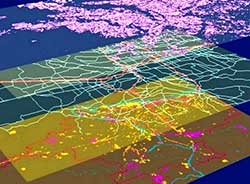
GIS Topic
"Ashliya Consultants Pvt Ltd" a niche provider of geometrics engineering to business and development organizations. Geometrics engineering is a modern discipline, which integrates acquisition, modelling, analysis and management of spatially referenced data, i.e. data identified according to their location. Based on the scientific framework of geodesy, it uses terrestrial, marine, airborne, and satellite-based sensors to acquire spatial and other data. It includes the process of transforming spatially reference data from different sources into common information systems with well-defined accuracy characteristics.
The company has leveraged its strong Geo spatial engineering and CAD background to offer multifaceted services to customers around the globe.
Contact Us